Finalization of the 2nd phase of the modeling of the transport in the inner ring of barcelona

A system for monitoring the elderly based on gas sensors and artificial intelligence
May 23, 2019
Architectural model of the Sagrada Familia’s Nativity Facade in 3D
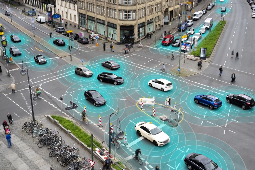
May 23, 2019inLab FIB UPC has completed the second phase of modelling transport in the first zone of Barcelona Metropolitan Area, as part of the Virtual Mobility Lab (VML) project, which is focused on developing new tools for urban planning.

VML is a methodological schema for analysing and assessing the impact of smart mobility projects in Barcelona, the results of which could be assessed before undertaking pilot projects. The aim is to support those who make decisions about mobility policies, as well as transport operators or new companies that develop new mobility alternatives and wish to assess them.
The first zone of Barcelona Metropolitan Area consists of 18 municipalities and has been divided into 630 transport zones (TAZ, Transport Analysis Zones) that are compatible with the administrative divisions (regions, municipalities, districts, census areas). Transport hubs have been considered specifically (for example, the airport). The city of Barcelona has been divided into around 350 TAZ on which this analysis is based.
In the first phase of the project, inLab FIB UPC develop the first detailed multimodal model of the Inner Ring of Barcelona Metropolitan Area that includes the offering of all public transport modes and private vehicles, and the mode demand of origin-destination (OD) mobility in 2017.
The second phase of modelling was designed to validate and partially calibrate the private transport model. In the past, transport data have come exclusively from government bodies. Now, inLab FIB has incorporated data from traditional sources into the study area at the level of day and time, as well as data from new technologies (mobile phones and geolocated fleets of vehicles). Processing these data enabled the initial construction of distribution of journeys between pairs of zones (origin-destination) in the study area. The results of the final model in the second phase of the project have been compared with the reference data at the level of the average day (data provided by the government, capacity and speeds and times from origin to destination from new technologies) satisfactorily.
In future phases of development, the calibration of public and private transport will be refined at the level of time bands.
The project is being developed in the hub of urban mobility, CARNET. The model of offering and demand for transport has been implemented in the commercial platform VISUM by PTV-AG. Other collaborators in the project are SEAT, PTV IBERIA, RACC, INRIX and Kineo.
Technology
Sector
Topic
You want to know more?
Related Projects
- The research and innovation laboratory at the Barcelona School of Informatics (inLab FIB) of the Universitat Politècnica de Catalunya - BarcelonaTech (UPC) is taking part, along with the distribution company Assolim, in the design of a test of concept to create optimised routes for each vehicle for transport on demand.
- A team of researchers from the Acoustic and Mechanical Engineering Laboratory (LEAM) in the Centre for Advanced Technologies in Mechanics (CATMech) at the Universitat Politècnica de Catalunya - BarcelonaTech (UPC) is participating in the development of a method that can generate and update noise maps for cities via mobile acoustic sensors.
- A multidisciplinary team at the Universitat Politècnica de Catalunya - BarcelonaTech (UPC) is working on the European project AI - Enhanced Fibre -Wireless Optical 6G Network in Support for Connected Mobility (6G-EWOC) to develop technologies and a 6G optical network that will combine artificial intelligence with 6G technologies, remote sensing systems and optical communication (wireless and by optical fibre). The result will be a network that will enable autonomous and human-driven vehicles to circulate safely, avoiding accidents in zones that have a lot of traffic or are very busy.
- The research group Barcelona Innovative Transportation (BIT) and the innovation and research laboratory of Barcelona School of Informatics (inLab FIB) at the Universitat Politècnica de Catalunya - BarcelonaTech (UPC) is taking part in the project eBRT2030 (European Bus Rapid Transit of 2030: electrified, automated, connected).


